Advanced GIS Solutions for Coastal Zone Management
Geo-Spatial Analysis for Coastal Areas: A powerful GIS-based solution that supports the conservation and sustainable development of coastal areas through real-time spatial data analysis.
Coastal zones are among the most dynamic and ecologically significant regions on Earth, requiring careful management to balance environmental preservation and human activity. Advanced GIS solutions play a pivotal role in addressing these challenges by integrating geospatial technologies with coastal management strategies. These tools enable stakeholders to analyze spatial data, monitor environmental changes, and implement sustainable development practices.
Spatial Analysis for Coastal Areas, Coastal Zone Management and Conservation
The Role of GIS in Spatial Analysis for Coastal Areas. GIS (Geographic Information Systems) offers comprehensive tools for mapping and analyzing coastal areas. These systems support tasks such as:
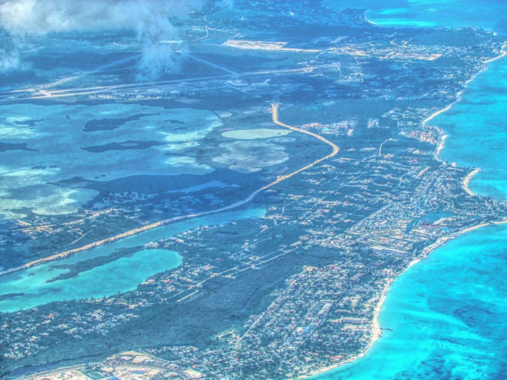
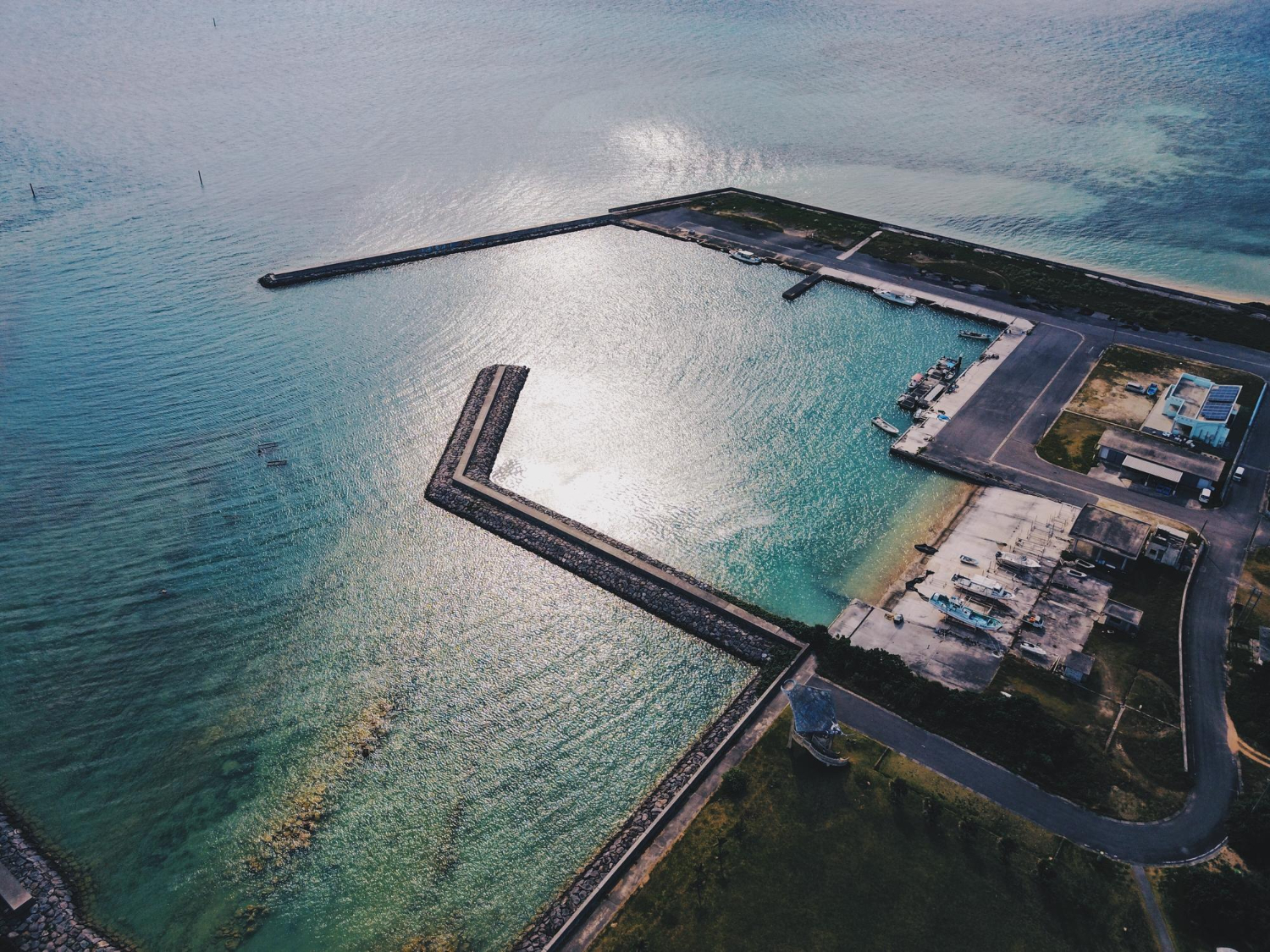
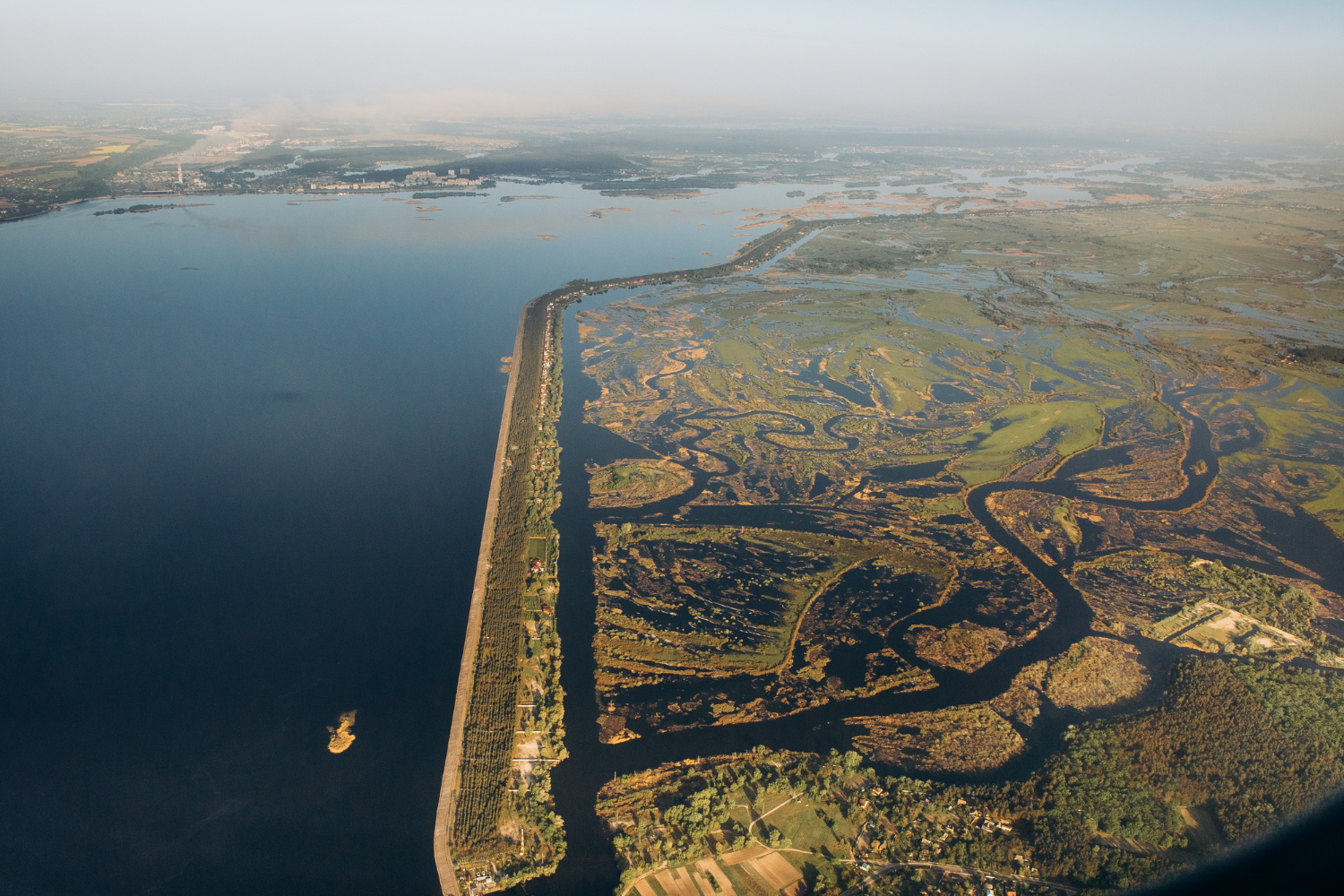
- Coastal Mapping and Monitoring: High-resolution spatial data and imagery are used to create accurate maps of shorelines, habitats, and infrastructure. This helps in identifying erosion-prone areas, tracking sediment movement, and monitoring mangrove depletion.
- Climate Change Adaptation: Advanced GIS facilitates the analysis of rising sea levels, coastal flooding, and storm surge impacts. Through predictive modeling, decision-makers can implement mitigation strategies.
- Habitat Conservation: GIS-based spatial analysis identifies critical habitats like wetlands and coral reefs, aiding conservation efforts and biodiversity protection.
Key Applications
Spatial Analysis for Sustainable Development:
GIS tools evaluate the impact of urban expansion, tourism, and industrial activities on coastal ecosystems. This ensures development plans align with environmental regulations and sustainability goals.Disaster Risk Management:
Coastal zones are often vulnerable to natural disasters such as tsunamis, hurricanes, and cyclones. GIS supports real-time data visualization, enabling faster emergency response and risk assessment.Integrated Coastal Management (ICM):
GIS facilitates collaboration among governments, scientists, and local communities by providing a shared platform for spatial data. This improves decision-making for land use planning, resource allocation, and environmental monitoring.
Benefits of Advanced GIS Solutions
- Accurate Decision-Making: Geospatial data integration provides a detailed understanding of complex coastal dynamics.
- Cost-Effective Management: Predictive modeling reduces costs associated with disaster recovery and environmental degradation.
- Enhanced Public Engagement: Visual tools like 3D coastal maps and interactive platforms promote awareness and participation among stakeholders.
Technologies Driving Innovation
Modern GIS solutions leverage cutting-edge technologies, including:
- Remote Sensing and LiDAR: For capturing topographical data and monitoring coastal changes.
- Drone Mapping: Offering detailed, real-time aerial imagery of vulnerable areas.
- Cloud-Based GIS: Allowing seamless data sharing and collaboration across regions.
Why Choose Global GeoSoft?
Global GeoSoft specializes in delivering advanced GIS solutions for Spatial Analysis for Coastal Areas. With expertise in spatial analysis, data integration, and mapping, our services empower organizations to make informed decisions for sustainable coastal development. Whether addressing habitat conservation, disaster risk reduction, or climate adaptation, our innovative tools and methodologies ensure effective outcomes tailored to the needs of clients worldwide.
By leveraging advanced GIS technologies & Spatial Analysis for Coastal Areas, we strive to protect and sustain coastal regions for future generations. Contact us to explore customized solutions for your coastal management challenges.

The Budget $1.1 million

Overview
This project is designed to protect and manage coastal regions by utilizing geospatial data to monitor environmental changes and mitigate the impact of climate-related events.
Short Detail
Advanced GIS Solutions for Coastal Zone Management integrates data from satellite sensors and field observations to track shoreline erosion, monitor marine habitats, and predict sea-level rise. This innovative system enables authorities to develop sustainable coastal development plans and conservation strategies.
By providing detailed visualizations of coastal dynamics, this platform helps in safeguarding marine biodiversity and reducing the risks posed by natural disasters. It plays a crucial role in preserving the ecological balance of coastal areas.
Advanced GIS Solutions for Coastal Zone Management empower data-driven decision-making for sustainable development and environmental protection